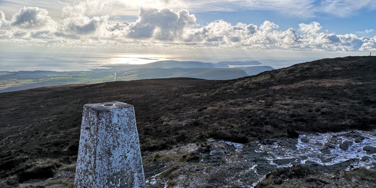
Welcome to Cronk ny Arrey Laa, a stunning hill in the Isle of Man’s south-west. Rising to 437 meters (1,434 feet), this peak stands as our region’s second-highest point after South Barrule. Moreover, its Manx name tells a story, meaning ‘Hill of the Day Watch’.
Natural Beauty
Along the western edge, dramatic cliffs drop straight into the sea. Furthermore, the hill offers some of the British Isles’ most amazing views. Throughout the boggy slopes, you’ll discover unique wildlife, including rare carnivorous sundew plants. Best of all, you can reach the start point easily, as it’s just 500 metres from the main road between Port Erin and Peel.
Historic Significance
Over centuries, this sacred site has gathered fascinating stories. At its heart lies Chibbyr ny Vashtey (‘The Well of Baptism’), an ancient holy well. Meanwhile, nearby Lag ny Keeilley’s ruins remind us of its time as a burial ground until 1800. In the past, local herring-fishers would watch this hill carefully – sunrise here meant it was time for fishing.
Getting There
Situated within Rushen parish at the top of the Sloc Road, the hill borders Patrick parish nearby. Additionally, it forms part of the popular Raad ny Foillan coastal path. Because of its location, visitors can enjoy a quick 500m walk from the main road.
Key Details
• Height: 437m (1,434 feet)
• Location: South-western Isle of Man
• Parish: Rushen
• Access: 500m walk from main road
• Path: Part of Raad ny Foillan
Helpful Tips
• First, check the weather forecast
• Next, wear good walking boots
• Then, pack your camera
• Also, bring water and snacks
• Finally, allow time to explore the historic sites

Recent Comments